Srinagar, Dec 30: Following the season’s first major snowfall, two Western Disturbances (WDs) are expected to impact Kashmir in the first week of January, potentially disrupting both surface and aerial connectivity in the Valley, officials said.
Dr. Mukhtar Ahmad, Director of the Meteorological Department Srinagar, informed Rising Kashmir that two WDs in quick succession are likely to affect Jammu and Kashmir and surrounding areas starting January 1.
“Between January 1-2, a feeble WD will bring generally cloudy weather with light snowfall in scattered places. Another moderate WD will hit the Valley from January 3-6, causing light to moderate snowfall in many areas and moderate to heavy snowfall in isolated higher reaches,” he added.
Dr. Ahmad further explained that the main activity of this weather system is expected to occur between January 4-5, with the possibility of heavy snowfall in isolated higher regions. He urged the public to follow traffic advisories due to sub-freezing temperatures and icy conditions on the roads.
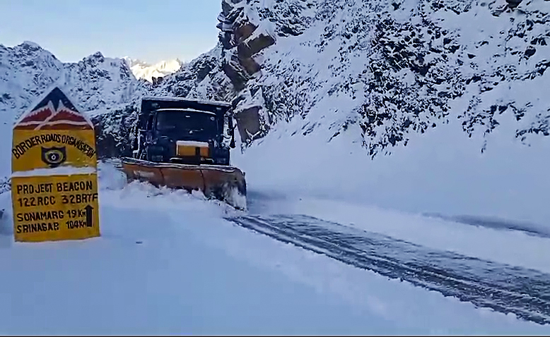
The first significant snowfall of the season, which followed an extended dry spell, was recorded on Friday in Srinagar and other parts of the Valley. The heavy snow temporarily severed air and surface connectivity to Kashmir for two days. However, both air and surface links have since been restored, and train services have resumed.
Meanwhile, there was an improvement in night temperatures across the region on Monday. The minimum temperatures dipped significantly, with Gulmarg recording the coldest at -10.0°C, followed closely by Sonamarg at -9.9°C and Pahalgam at -9.2°C. Srinagar recorded -0.9°C, while Baramulla, Pulwama, and Anantnag recorded -1.2°C, -0.2°C, and -1.0°C, respectively. Southern districts such as Shopian and Kulgam recorded -3.1°C and -3.0°C.
In the Jammu region, the cold was less severe but still persistent. Bhaderwah and Padder recorded -3.1°C and -7.0°C, respectively, while Jammu city registered a milder 4.6°C. Katra recorded 6.2°C, and Kathua reported 6.8°C, the highest in the region.
Ladakh recorded the coldest temperatures, with Drass at -21.8°C, Kargil at -15.3°C, and Leh at -13.2°C, reflecting the region’s extreme winter conditions.
Meanwhile, traffic along 270 Kilometres Jammu-Srinagar National remained normal on Monday and vehicles were allowed from both sides to move to respective destinations.
A traffic police spokesman said that during the past 24 hours, there was slow movement observed on NH-44 due to breakdown of HMVs, single lane traffic at Dalwas, Mehad and between Marog & Kishtwari Pather.
On Srinagar-Jammu highway, LMVs Passenger/Private Cars/HMVs shall be allowed from both sides on Jammu-Srinagar NHW (NH-44) viz from Jammu towards Srinagar and vice-versa. The Traffic Control Units (TCUs) in Jammu and Srinagar will coordinate with the TCU Ramban to monitor the road’s status.
On the Srinagar-Leh Highway, one-way traffic for LMVs equipped with anti-skid chains will be allowed from Kargil to Srinagar. Vehicles traveling along this route will be permitted to cross Zozila between 10:00 AM and 3:00 PM. No vehicle will be allowed to proceed after the cutoff time.
Two western disturbances to impact Kashmir in early Jan
• Peak activity of spell between Jan 4-6: MeT • Gulmarg settles at -10.0°C, Sonamarg at -9.9°C • Sgr-Jmu NH to remain open for two-way traffic today

Leave a Comment Leave a Comment