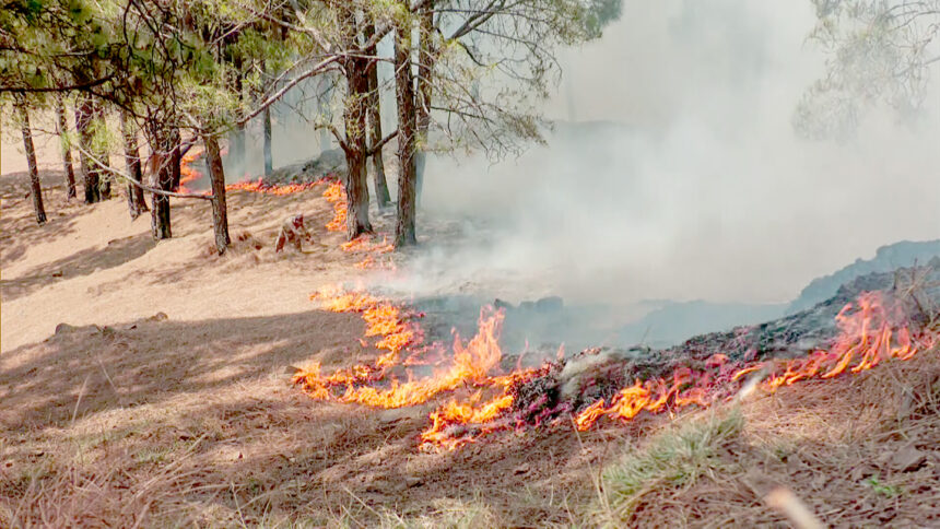
Pulwama, Apr 06: Amid the growing threat of forest fires in Kashmir, experts are calling for the adoption of advanced technology alongside traditional methods to effectively combat the crisis.
Dr. Javid Ahmad Mughloo, Professor and Chief Scientist at SKUAST-K, said Kashmir has been witnessing a disturbing rise in forest fires over recent months.
“The increasing number of fire incidents poses a grave threat to our rich biodiversity and ecological balance,” he said, attributing the surge to rising temperatures and prolonged dry spells.
Dr. Mughloo noted that while the forest department, in coordination with local volunteers and disaster response teams, has been launching containment measures, the region’s rugged terrain and limited resources make firefighting a formidable challenge.
He stressed the need for improved preparedness, public awareness campaigns, and strict preventive regulations to minimize damage. “Addressing the issue requires a blend of cutting-edge technology and time-tested traditional practices,” he said.
According to Dr. Mughloo, advanced tools such as AI and satellite-based early warning systems, drones equipped with thermal imaging, IoT-enabled sensor networks, controlled burn robotics, digital twin forest platforms, and community-based mobile alert apps should be explored.
He explained that AI models trained on satellite data can monitor vegetation dryness, detect heat signatures, and predict high-risk fire zones in real-time.
“Drones equipped with thermal cameras can patrol forests even at night, identifying smoldering spots before they escalate into major wildfires,” he said, adding that drones can also be used to drop fire retardants or deliver supplies to inaccessible areas.
Smart sensors installed in vulnerable forest zones, he said, can track temperature, humidity, and detect smoke or sudden heat spikes, triggering instant alerts.
He also emphasized the potential of AI-guided robots and controlled burning techniques to reduce flammable material and prevent the spread of fires. “We can even develop a real-time 3D simulation of Kashmir’s forests using GIS, satellite, and drone data to visualize fire spread, plan responses, and assess environmental impacts,” he added.
Dr. Mughloo highlighted the role of real-time mobile alert apps powered by AI and crowdsourced data in informing locals and tourists about fire risks, safe zones, and evacuation routes.
“Given the Valley’s unique geography, solar-powered drone stations, satellite-connected IoT systems, and snowmelt pattern analysis could play a critical role in fire risk assessment,” he said.
He said that several agencies in India can assist the forest department in mitigating forest fires by providing funding and support to implement the advanced scientific techniques mentioned above, thereby helping to preserve the region’s natural resources.
Experts call for modern tech to combat surging forest fires in Kashmir

Leave a Comment Leave a Comment


