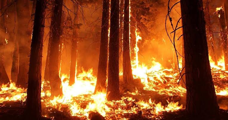
In Jammu and Kashmir at least 1,747 square kilometres of forest area have been categorized in ‘High Risk’ zone of forest fire while 62 square kilometres have been categorized in ‘Very High Risk’ zone.
The official document available with the news agency—Kashmir News Observer (KNO) reveal that “62 square kilometres of forest area of Jammu and Kashmir is under High Risk’ zone of forest fire and 8,972 square kilometres of forest area lie under moderate risk zone and 10,606 square kilometres of area with low risk of forest fire respectively.”
The documents however state that 62 square kilometres of forest areas have been categorized in ‘Very High Risk’ zone in terms of catching forest fire while 33,237 square kilometres of forest areas of Jammu and Kashmir have been categorized as ‘No Risk’ zone.
It states that certain regions across India are more susceptible to forest fires due to factors like type of fuel load, local human activities, topographical features, forest type, and climatic conditions.
“In order to have a better and robust system for controlling and managing forest fires in a region, an effective fire risk zonation helps to delineate different risk areas for prioritizing management interventions in an effective manner,” it reads.
The documents said that a pilot study has been carried out for the West Himalayan State, UT comprising Himachal Pradesh, Uttarakhand, Jammu and Kashmir, and Ladakh to identify Fire Risk Zones and categorize them into different risk classes using suitable variables.
“In Jammu and Kashmir, 79.01 % of the detections fall under 19.74 % of the Digitized Boundary Area.” It reads.
The document of the Ministry of Environment, Forest and Climate Change further states that frequency of detected forest fires in an area over a period of time indicates proneness of the area to forest fires. “Maps showing forest area in different classes of fire proneness can be an effective management tool for controlling forest fires.
“Such maps can be used for optimally utilizing scarce resources available for controlling forest fires in the fire season. Increased vigil in highly fire prone forest areas may prevent forest fires effectively. Considering the usefulness of mapping fire prone forest areas, analysis of the detected forest fire points in GIS framework along with a grid coverage of 5 Km X 5 Km and latest forest cover has been carried out for the whole country,” it reads—(KNO)