Heavy snowfall hits normal life in Valley;flights off, NH closed
-
 Irfan Yattoo
- Comments 0
- 30 Jan 2023
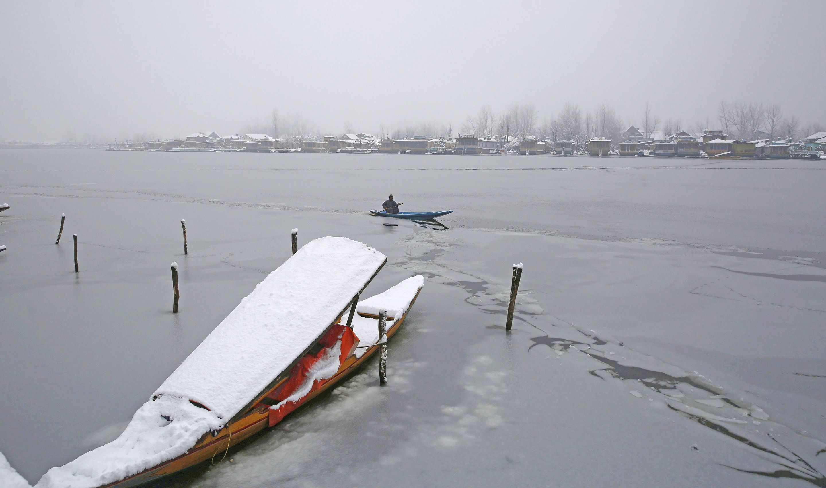
Srinagar, Jan 30: Normal life was thrown out of gear, on the final day of the Chilla-I-Kalam, considered to be the harshest period of winter, on Monday as heavy snowfall disrupted the aerial as well as surface connection of Jammu and Kashmir UT from rest of the world.
Heavy snowfall across the Jammu and Kashmir since Sunday night disrupted normal life on Monday, including examinations at Kashmir University.
Director Srinagar International Airport Kuldeep Singh told Rising Kashmir that due to heavy snowfall and poor visibility 68 to-and-fro flights were cancelled at Srinagar International airport.
"We had 68 scheduled flights today. All 68 flights were cancelled due to low visibility and continuous snowfall. All airlines will accommodate the passengers of the cancelled flights in the next available flight without any extra charges,” he said.Director said the passengers may also opt for a full refund at their convenience.
The Jammu-Srinagar national highway, the major surface link connecting Kashmir valley with the outside world, was closed due to shooting stones and mudslides in various stretches, SSP Traffic Srinagar-Jammu highway, Mohita Sharma said.
A traffic police department official said around 2500 vehicles are stranded along the Srinagar-Jammu highway. While no fresh traffic will be allowed on the highway on Tuesday. Landslides, shooting stones, and mudslides have blocked the highway at several places. Men and machinery are on the job to restore the highway as soon as possible,” he said.
Following the heavy snowfall in Kashmir, the authorities suspended the train services along Banihal- Baramulla railway section.
Chief Area Manager (CAM) Kashmir, Saqib Yousuf Yatoo (IRTS) told Rising Kashmir that heavy snow is accumulated along railway tracks in Kashmir parts. Once the weather will be improved snow will be cleared along tracks and trains will be chugged normally," he said.
In the latest weather advisory, the Meteorological Department said moderate to heavy rains, and snowfall occurred at most places of J&K with higher reaches reporting 1-2 feet of snow and thunderstorms in the Jammu region.
Director MeT, Sonam Lotus told Rising Kashmir that they were expecting overall improvement in prevailing weather conditions from Tuesday onward. There will be a gradual decrease in precipitation from later tonight, he said.
“On Tuesday, the weather will remain cloudy with light Snowfall, and rain at isolated to scattered places in the region, Lotus said.
At many places in south Kashmir, the depth of snow was recorded as over 2-3 feet, which hampered pedestrian movement. The administration has set up several control rooms to help people across the Valley and asked them to remain on high alert.
In Srinagar snowfall started on Sunday late night. The intensity and distribution of the snowfall picked up on Monday early morning across Kashmir with intermittent snowfall in the plains and heavy snowfall in higher reaches.
As per MeT officials, Srinagar city received 9 inches of snowfall, ski-resort Gulmarg in Baramulla recorded a fresh spell of 2 feet of snowfall, Tangmarg 1 feet, Pahalgam 1.5 feet, Sonamarg 2 feet, Qazigund, 1.5 feet, Shopian 1.6 feet.
Pulwama 1 feet, Tral 1.5 feet, Kulgam 2 feet, Kokernag, 1.8 feet, Banihal 9 inches, Jawahar Tunnel 11 inches, Kupwara 1 feet, Baramulla 14 inches, Ganderbal 11 inches, Bandipora 18 inches, Budgam 1 feet and Anantnag 1-2 feet.
Peer ki Galli also witnessed heavy snowfall and recorded more than 2 feet till Tuesday evening. Marwah in Kishtwar received 2.7 feet, Warwan 3 feet. Sinton Top, Minimarg, Sadhna Top, Zojila Pass, and Drass also received heavy snowfall till late evening. Karna, Keran and Machil sector in Kupwara witnessed heavy snowfall.
The heavy snowfall paralyzed normal life in Kashmir with the majority of the areas remaining cut off from the district headquarters and link roads remained blocked in the region.
Jammu and Kashmir Disaster Management Authority issued an avalanche warning for ten districts of UT for the next 24 hours in the region.
The JKDMA spokesperson has warned of possible 'High Danger Level' avalanche above 2500 metres above sea-level over Doda, Kishtwar and Poonch districts.
Avalanche with 'Medium Danger Level' is likely to occur above 1500 to 2500 metres over Bandipora, Baramulla, Ganderbal, Kupwara, Kulgam and Ramban, he said.
While avalanche with 'Low Danger Level' is likely to occur above 1500 metres over the Anantnag district.
"People living in these areas are advised to take precautions and avoid venturing into the avalanche-prone areas", he added.
Related Posts
-

J&K’s Ranji win proud moment: PM Modi
-

Jammu Marathon symbolises J&K’s transformation: LG Sinha
-

Physical fitness integral to societal progress: CM Omar
-

J&K dairy grows 15%, but 7.4% samples fail safety tests
-

Kashmir’s rooftops power new energy dawn
-

Payroll Without Purpose
-

Self-styled journalists misusing platform, MLA Uri in assembly
-

Omar Abdullah urges ceasefire, calls on PM Modi to mediate Iran crisis
-

LG Sinha suspends Anantnag ADC, reassigns officer to Div Com Kashmir
-

LG, CM greet people on Mahavir Jayanti
-

J&K Govt orders transfers, postings
-

Govt to review District Planning Boards framework
-

150th Anniversary Closing Ceremony : Vande Mataram our identity, strength & vow: LG Sinha
-

Mission YUVA should become national benchmark: CM
-

LG assents to three Bills passed by LA

Leave a comment